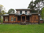
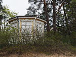
After breakfast in the hotel I circle a bit in Narva-Jõesuu but spot only a few examples of nice old architecture.
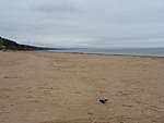
This place used to be famous for its wooden houses but most of it fell into disrepair during soviet occupation and was either demolished or rebuilt. Rain isn’t very supportive of sightseeing or taking pictures anyway. I had to put rain gear on right away. A man shows an uplifted thumb from the other side of the road. Narva-Jõesuu is worth a visit. Parking is not free and beaches are empty during May except for doves. The cycle roads are built Tallinn-style, with sharp edges.
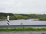
I turn south with a hope for better weather. Now I ride parallel to Narva river and Russia is visible on the other side. Here and in the south we can see our neighbor unlike on the northern coast where Finland is nowhere to be seen and you actually cannot even see the border.
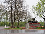
At entrance to Narva is a tank on a hill, red pentagon on the side, pointing towards Estonia. That’s weird.
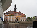
Heavy rain in Narva. I take a few pictures of the city hall and the college and visit café Muna (it means egg). I let myself to be persuaded to take cake along with coffee. This seems to be an Estonian oasis in this mostly Russian-speaking city.
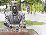
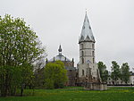
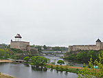
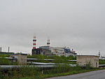
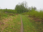
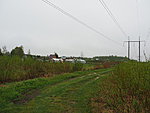
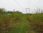
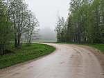
Rain hasn’t stopped outside and after sitting inside it feels now also chilly. The last one passes quickly. Chess champion Paul Keres sits in the rain deep in thought and waits for someone to play with him. I photograph the Herman castle and Aleksander church and head for the power plant, a swarm of gull flying in front of me. The power plant is locked in the place from where according to the map goes the most direct road towards lake Peipsi. In front of an alternative road is a sign forbidding entry with a warning that it would be life-threatening. I weight the matter. What could happen. There is a well-trodden path next to the gate. I have to pass 300 meters then there’s a footpath and after that the map shows some kind of civilization. No-one notices me. The footpath is a real footpath, a narrow line in the bush, past self-organized garbage hills, over the railroad and under giant power lines. Air sizzles with electricity and only the helmet stops my hair from raising towards the sky. And how much is going on under the power lines! Everywhere vegetable beds, greenhouses and tiny cottages. I stop at a car to look if the grass ahead is passable when a voice inquires if the car is on my way. No, it is not. I ask if it is possible to get to Auvere through here. Yes, the woman gesticulates ahead and tells me not to cross the railway. On the other side of the bush is paved road. To the right is the railway judging by the noise. To the left should be paths that lead to big road. It goes between a better organized summer house area. In front of my chosen way is a dead-end sign. Is the thought „how dead-end can it be“ something that’s characteristic of cyclists in general? When I press on then there are strict orders not to enter but no-one in sight. Finally I’m clearly in someone’s yard and there seems to be no way through. The yard is full of curious objects. Two dogs start to bark and after a while a man appears from one of the houses. He speaks to the dogs in Estonian. Has been retired here for 15 years and Narva city municipality even clears the road of snow in the winter. Does not mind my invasion on his property but tells me that there’s a gravel road right before the railway. It goes three kilometers through the forest to Arumäe and then a paved road continues towards Auvere. So it is indeed. Thick fog appears. The rain that had stopped, starts again.
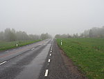
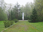
The paved road is smooth, there is virtually no traffic and my average speed rises considerably. Next to the road is another monument commemorating the freeing of soviet Estonia in 1944. Well, we’re not actually very grateful for that.
Next obstacle is the mining area of Eesti Energia (Estonian Energy). The entry gate is high and with barbed wire. No manned gate anymore. Probably people have been removed for too soft attitude towards cyclists. I get in but with an agreement that I don’t say how it happened. A responsible hiker agrees a passage beforehand with Eesti Energia.
I have three descriptions about crossing the mine but I also happen to know that a group of cyclists went ahead of me today. Their traces are well visible on the muddy ground. I suppose they knew how to get through.
First puddle with big stones gets me crashed. I jump up immediately but muddy water has already found its way inside my sleeve and trousers. About a hundred meters later I discover that one of the sidebags has also got loose and the securing elastic band spinned itself to the rear wheel. So I spend some time squatting in the mud to get it detached and rearrange everything. Two lessons from this: walk over big stones and after crashing check the bags right away.
The mine continues with wide muddy roads that disappear into the fog on the horizon. When reaching horizon and turning around the corner there is more of exactly the same view. And many times like that. In addition to balancing in the mud I have press myself through a wall of water. Very good, washes the mud off. The inhospitable environment has to be blamed for no pictures of the mud fields.
Finally I reach the gate that announces the end of the mine. Cheers. Remaining kilometers until Poruni hiking trail I use bicycle bell occasionally because the bear pictures would not come out very well in this rain either.
To explain the hassle with the closed territories. It’s huge area along the border that is closed to the public but a detour would be about 70 km. This is especially frustrating to people who want to hike or cycle along the border. That’s why the half-illegal entries.
I have even two cars waiting for me. In addition to Kalle also the border guards. Lovely. Kalle suggests that I continue with wet toes along the muddy and bumpy road for another four kilometers to paved road from where it is better to start on Monday. Because now I head for a short musical break.
Today’s distance 76 km.
Add a comment